
Greenfield Canal Alignment Survey — 330 km
Water Resources · Odisha border to Rajahmundry, Andhra Pradesh
Published · Updated
Project Overview
Bearing Technology Private Limited (BTPL) carried out a UAV photogrammetric topographic survey of a 330 km greenfield canal alignment from the Odisha border to Rajahmundry, Andhra Pradesh, for Balaji Surveyors Pvt Ltd, delivering a coordinated terrain model, orthophoto mosaic and CAD drawings for the full alignment.
BTPL carried out a UAV photogrammetric topographic survey along a 330 km greenfield canal alignment running from the Odisha border to Rajahmundry in Andhra Pradesh, engaged by Balaji Surveyors Pvt Ltd. On a greenfield alignment there is no existing canal or formation on the ground, so the terrain model along the proposed corridor has to be built entirely from new survey. The work was executed as a corridor survey, capturing a continuous strip along the proposed route rather than a single centre line.
What did Balaji Surveyors Pvt Ltd require?
A greenfield canal alignment requires a single, continuously coordinated ground model along the corridor so that the alignment, bed levels and hydraulic gradient can be fixed on consistent data. The same survey has to support earthwork assessment, siting of cross-drainage and canal structures, and identification of the land and assets falling within the proposed corridor. Corridor-width coverage, rather than coverage of a fixed centre line, allows alternative alignments to be compared on the same base data during design.
What made this project challenging?
- A 330 km linear corridor, on which survey control must be carried the full length without allowing error to accumulate between the ends of the alignment.
- Variation in terrain and land cover along a route of this length, which affects flight planning, ground control spacing and the extent of supplementary ground survey required.
- Vegetation, standing crops and plantations where present along the corridor, which obscure the bare ground surface and call for careful ground classification and field checks.
- Watercourse and road crossings within the corridor, each requiring adequate coverage on both banks for cross-drainage planning.
- Mobilisation, access and permissions along a route crossing many landholdings and revenue boundaries, with field work planned around cropping cycles and seasonal weather windows.
How did BTPL carry out the survey?
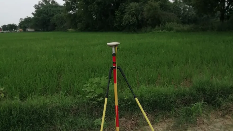
BTPL began by establishing a GNSS control framework along the full corridor, observed and adjusted so that the entire 330 km was held on one common datum and projection rather than on locally independent setups. Pre-marked ground control points and independent check points were laid out along the strip and coordinated by DGPS and RTK observation before flying commenced. UAV photogrammetric capture was then flown block by block along the corridor with planned forward and side overlap, sequencing blocks to suit airspace clearances, weather and ground conditions. Adjacent blocks were flown with sufficient tie-in, and where vegetation, canopy or built-up detail limited photogrammetric visibility, conventional ground survey was used to supplement the aerial data before the blocks were merged into a single continuous corridor model.
How was the data processed?
Imagery was processed through aerial triangulation constrained to the surveyed ground control, followed by dense image matching to generate the corridor point cloud. The cloud was classified to separate ground from vegetation, structures and other above-ground features, from which the DTM and DSM were built and the orthophoto mosaic produced. Contours, the longitudinal section and cross-sections at design chainages were extracted from the terrain model into CAD, with planimetric features digitised from the orthophoto and field notes.
How was accuracy verified?
Independent check points, held out of the photogrammetric adjustment, were used to verify the terrain model along the corridor, and additional field levels were observed by RTK as a cross-check on the classified ground surface. Overlap zones between adjacent blocks were compared to confirm that the merged corridor model was continuous and free of steps at block joins. Classified ground under vegetated and cropped stretches was reviewed manually, and all extracted contours, sections and CAD deliverables were checked back against the project datum and the agreed layering and drawing standards before issue.
What was delivered?
Balaji Surveyors Pvt Ltd was issued a single coordinated terrain model, orthophoto mosaic and CAD deliverable set covering the full 330 km alignment, allowing the canal alignment and its hydraulic profile to be studied on continuous data rather than on independently surveyed local blocks. The deliverables provide the base for earthwork assessment, structure siting and corridor-level planning along a route where no prior ground model existed.
 Balaji Surveyors Pvt Ltd
Deliverable extracts (orthomosaic, terrain, CAD) will be added once cleared for publication (client-sensitive information removed per BTPL policy).
Planning a Similar Project?
Share your location, scope and required deliverables — BTPL will propose the appropriate survey methodology.