
NHAI Highway Corridor Surveys — Cuttack & Sambalpur
Roads & Highways · Cuttack and Sambalpur, Odisha
Published · Updated
Project Overview
Bearing Technology Private Limited (BTPL) carried out a UAV photogrammetric survey of 121 km of existing highway corridor in Odisha — 86 km at Cuttack and 35 km at Sambalpur — for NHAI, through Balaji Surveyors Pvt Ltd, delivering a coordinate-consistent topographic base with orthoimagery for upgradation design.
BTPL executed UAV corridor surveys of existing national highway sections at Cuttack and Sambalpur in Odisha for NHAI, through Balaji Surveyors Pvt Ltd. The work covered 121 km of existing road in total, comprising 86 km at Cuttack and 35 km at Sambalpur. Both corridors were captured photogrammetrically to produce a topographic base of the existing carriageway, its shoulders, drainage and adjoining land.
What did the client require?
NHAI required a current topographic base of the existing alignment to support upgradation and improvement design. The data had to describe the built road and everything alongside it — carriageway geometry, drains, structures, utilities, roadside development and land width — in a form usable directly for design levels, earthwork assessment and land requirement studies. Deliverables therefore had to combine measurable surface geometry with visually interpretable imagery on the same coordinate framework.
What made this project challenging?
- Live highway operation throughout the survey, requiring control marking and any work on the carriageway or shoulders to be carried out without interrupting traffic and without exposing crew to running vehicles
- Two geographically separated corridors totalling 121 km, needing independent mobilisation, control frameworks and flight programmes at Cuttack and Sambalpur while producing a consistent deliverable at each location
- Built-up frontage along sections of the route, where structures and roadside occupation extend towards the road boundary and built detail has to be captured up to the edge of the land width
- Roadside trees and vegetation overhanging the carriageway edge, masking drains, toe lines and the ground surface in photogrammetric capture and calling for supplementary ground measurement
- Overhead power lines, road structures and other obstructions typical of an operating corridor, which constrain flight lines and altitude and have to be planned around section by section
- Weather and atmospheric conditions, including wind and haze, narrowing the usable flying window on any given day
How did BTPL carry out the survey?
Control was established first: a DGPS network was observed along each corridor and tied to published reference, with ground control and independent check points distributed through the full length of both stretches and marked so that they remained identifiable in the aerial imagery. UAV capture then followed pre-planned corridor blocks flown with overlapping strips and cross strips at the block ends, with flight height and line spacing set against the required mapping scale and the obstructions present on each section. Detail the camera cannot resolve — ground under dense canopy, drain inverts, culvert and structure detail, and utility positions — was picked up by supplementary ground measurement on the same control framework, so that no part of the corridor rested on interpolation. Aerial and ground-surveyed data were then integrated into a single continuous corridor deliverable for each location.
How was the data processed?
Imagery was processed through aerial triangulation using the surveyed ground control, followed by dense image matching to generate the corridor point cloud. The point cloud was classified to separate ground from vegetation and structures, from which the DTM and DSM were derived and the orthomosaic produced. Features were then extracted into CAD as line work and levels, and the longitudinal section and cross sections at chainage were generated from the terrain model.
How was accuracy verified?
Points surveyed on the ground were withheld from the adjustment and used as independent check points, with residuals reviewed along the corridor before a block was accepted. Terrain and extracted feature levels were compared against ground-observed spot levels, particularly at drains, structures and canopy-affected stretches where photogrammetry alone is weakest. Adjoining blocks were edge-matched for level and feature continuity, and CAD deliverables were checked for layering, string continuity and topology before submission.
What was delivered?
NHAI received a continuous, coordinate-consistent topographic base across 121 km of existing highway at Cuttack and Sambalpur, combining measurable terrain geometry with orthoimagery of the corridor as it stands. Geometric improvement, earthwork assessment, drainage design and land requirement studies could be taken up from a single measured base rather than from separate and unrelated site records.
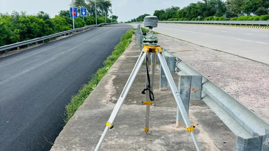
NHAI · via  Balaji Surveyors Pvt Ltd
Deliverable extracts (orthomosaic, terrain, CAD) will be added once cleared for publication (client-sensitive information removed per BTPL policy).
Planning a Similar Project?
Share your location, scope and required deliverables — BTPL will propose the appropriate survey methodology.