
Kishtwar Bathymetric Survey — HEP Project
Power & Hydro · Kishtwar, Jammu & Kashmir
Project Overview
BTPL surveyed a reach of river at Kishtwar in Jammu & Kashmir bathymetrically for NHPC, in connection with a hydro-electric project. The work measured the bed beneath the water surface and modelled it as a continuous surface referenced to control established on the banks, so that the submerged ground was described on the same datum as the ground around it. The bed contours, cross sections and capacity computation required for the project were all derived from that one surface.
What did NHPC require?
A hydro-electric scheme is designed against the shape of the river bed as much as against the flow in it. Storage or pondage volume, the level–area–capacity relationship, the setting of diversion, intake and tailrace structures, and the assessment of how sediment will accumulate all depend on a measured bed rather than an assumed one. None of that bed is visible or reachable by conventional topographic survey, so it has to be sounded and then brought onto the same vertical datum used on land, so that levels above and below the water surface read as one continuous ground model. The same measured surface serves as the baseline against which siltation and bed change can be compared later in the project's life.
What made this project challenging?
- Control had to be established on the banks at positions from which the water's edge could be reached and a boat launched and recovered, which limits where the framework can sit.
- Holding a sounding line against a current. On a river it is line keeping, more than instrument performance, that sets the limit on data quality.
- The water surface cannot be treated as a fixed reference, so levels had to be observed through acquisition and every sounding reduced to a common datum, not to the level of the day.
- Acoustic returns need interpretation and filtering before they can be accepted as bed level, and the bed is the one thing on the job that cannot be checked by eye — it is what the survey was commissioned to establish.
- Satellite visibility could not be assumed along the whole reach, so occupation was planned around it and positioning supported from the bank control.
- A strip between the safe working draught and the bank, which has to be closed by other means if the surface is to run from bank to bank.
How did BTPL carry out the survey?
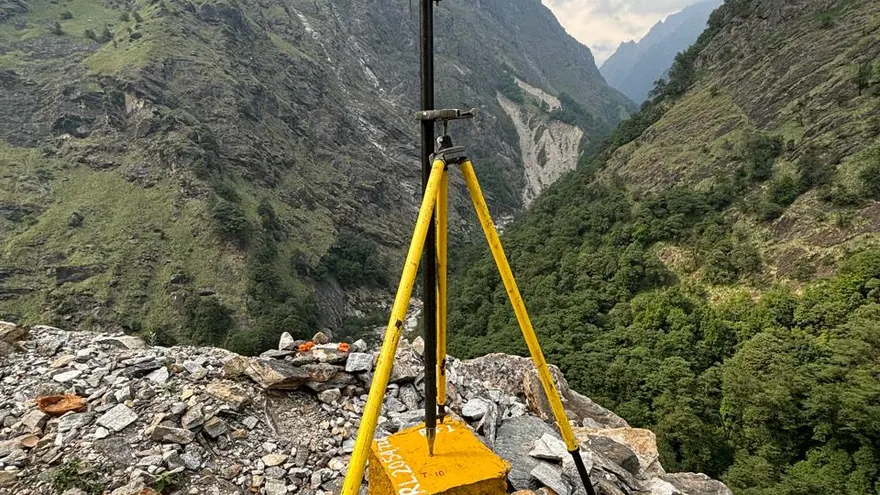
Control was established first on the banks, observed by GNSS, tied to the national datum and connected to available project reference marks, so that the bathymetric surface and the levels around the site would sit on one framework. Water level reference points were set at the reach and observed during acquisition, so that soundings taken at different times could be reduced to a common datum. Sounding followed, by echo sounder positioned by DGPS from that same framework, running cross lines across the channel at the agreed interval together with longitudinal runs and independent check lines to give redundancy over the bed. Where the water became too shallow to work from the boat, the margin and the bank line were observed by GNSS instead, on the same control, so that the sounded data and the surveyed ground meet along a common edge.
How was the data processed?
Each sounding was corrected for transducer draft and for sound velocity, reduced against the water level observed at the time it was taken, and passed through a filter to remove returns that could not be accepted as bed. What survived was combined with the GNSS-observed margins and bank line and gridded into one surface running from bank to bank. Bed contours and the chainage cross sections were cut from that surface. The capacity computation was integrated between successive elevations on the same surface, and it covers only the elevation range the survey actually reaches — from the sounded bed up to the highest bank and margin levels observed — so that the figures are not read beyond the ground they were measured from. Datum, projection and the basis of reduction were recorded with the data.
How was accuracy verified?
Instrument checks were made on site and repeated through the work: a bar check on the transducer and observed sound velocity, with established control re-occupied to confirm that positioning had not drifted. Agreement between the cross lines, the longitudinal runs and the check lines was then examined where they intersect, and the differences settled before any surface was built from them. Water level records from the reference points were compared against one another, so that the reduction applied to each block of data could be relied on. The gridded surface was read back against the reduced soundings to confirm that no real bed feature had been smoothed out of it. The capacity computation was left until last and run only on the accepted surface, so that every volume reported traces back through checks already made.
What was delivered?
What NHPC holds for the reach is a single measured bed surface, with the bed contours, cross sections and capacity computation all cut from it and held on the project datum. Storage and hydraulic assessment, sediment study and the setting of project structures can be worked from observed bed levels, and the same surface stands as the record against which later change in the bed can be measured.
NHPC
Deliverable extracts (orthomosaic, terrain, CAD) will be added once cleared for publication (client-sensitive information removed per BTPL policy).
Planning a Similar Project?
Share your location, scope and required deliverables — BTPL will propose the appropriate survey methodology.