
Imphal River Bathymetric Survey — 200 km
Water Resources · Imphal, Manipur
Published · Updated
Project Overview
Bearing Technology Private Limited (BTPL) carried out an echo-sounder bathymetric survey of 200 km of the Imphal river for Balaji Surveyors Pvt Ltd, delivering a continuous, datum-consistent bed model with cross sections and a longitudinal profile.
BTPL executed a bathymetric survey covering 200 km of the Imphal river in Manipur, as sub-consultant to Balaji Surveyors Pvt Ltd. The work captured river bed levels, cross sections and the longitudinal profile continuously along the reach, referenced to a control network established on the banks. Outputs were prepared in CAD and GIS formats for use in river engineering and water resources planning.
What did Balaji Surveyors Pvt Ltd require?
The survey was required to provide a measured bed profile of the river to support hydraulic assessment, capacity and sedimentation studies, and the planning of bank protection and river training works. Cross sections and a continuous longitudinal profile were needed at consistent chainage so that flow modelling and volume computation could be carried out along the full reach. The data also establishes a baseline against which future changes in the bed can be compared.
What made this project challenging?
- Sustaining consistent survey quality over a continuous 200 km reach with changing channel width, bed character and flow behaviour
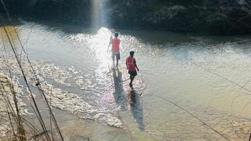
- Shallow reaches, sand and silt bars and submerged obstructions that restrict boat draught and require careful line planning, with wading observation where the boat cannot operate
- Limited launch and recovery points, with vegetation and unstable banks constraining access for control establishment and boat handling
- A working window governed by flow and water level, since discharge and water clarity in the region vary with the monsoon cycle
- Maintaining a single datum and continuous chainage across working sections surveyed at different times
How did BTPL carry out the survey?
BTPL first established GNSS control along the banks at intervals suited to continuous working, tied to published reference stations and extended by DGPS/RTK so that all soundings and bank features share one datum. The reach was divided into manageable working sections, each with defined chainage, bank benchmarks and water level reference points observed during acquisition. Bathymetric data was collected using a boat-mounted echo sounder with GNSS positioning, running cross sections at the agreed chainage interval together with longitudinal and check lines. Shallow and inaccessible margins were picked up by RTK wading or bank observation so that each section closes to the surveyed bank line. Data was integrated section by section as the work progressed, so that the profile remained continuous across the working sections.
How was the data processed?
Raw soundings were reduced for transducer draft, sound velocity and observed water level, then filtered to remove spurious returns before being combined with the RTK-observed shallow margin data. The corrected dataset was gridded to produce bed levels and depth contours, from which cross sections and the longitudinal profile were extracted at the agreed chainage. Final plans, sections and data files were prepared in CAD and GIS formats with consistent chainage referencing along the reach.
How was accuracy verified?
Sounder performance was verified through bar checks and sound velocity observation during acquisition, and positional quality was checked by re-observation on established control. Cross-line and check-line comparison at line intersections was used to assess the internal consistency of the bed surface, with water level records cross-checked against bank reference points. Sections were reviewed for continuity at the junctions between working sections before release.
What was delivered?
Balaji Surveyors Pvt Ltd received a continuous, datum-consistent bed model of the Imphal river across the 200 km reach, with sections suitable for hydraulic and sedimentation analysis. The data provides a working basis for river training, bank protection and water resources planning, and a reference baseline for monitoring future change in the bed.
 Balaji Surveyors Pvt Ltd
Deliverable extracts (orthomosaic, terrain, CAD) will be added once cleared for publication (client-sensitive information removed per BTPL policy).
Planning a Similar Project?
Share your location, scope and required deliverables — BTPL will propose the appropriate survey methodology.